Maps of Forres Angling Association Pools
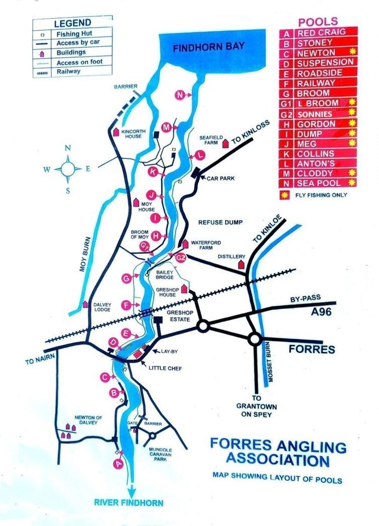
The map above may be viewed together with the Google satellite maps and images below.
The Google satellite images below show the stretch of the River Findhorn controlled by the Forres Angling Association. The first map shows the location of the upper pools, from Red Craig down to the Railway Bridge Pool, while the second shows the pools on the lower river, below Broom of Moy, i.e. from Broom Pool to the Sea Pool and Skater. The majority of the pools have convenient vehicle access. Photographs of the main salmon fishing pools on the Association water may be viewed by clicking the pool names below each map.
Upper Pools, Forres Angling Association
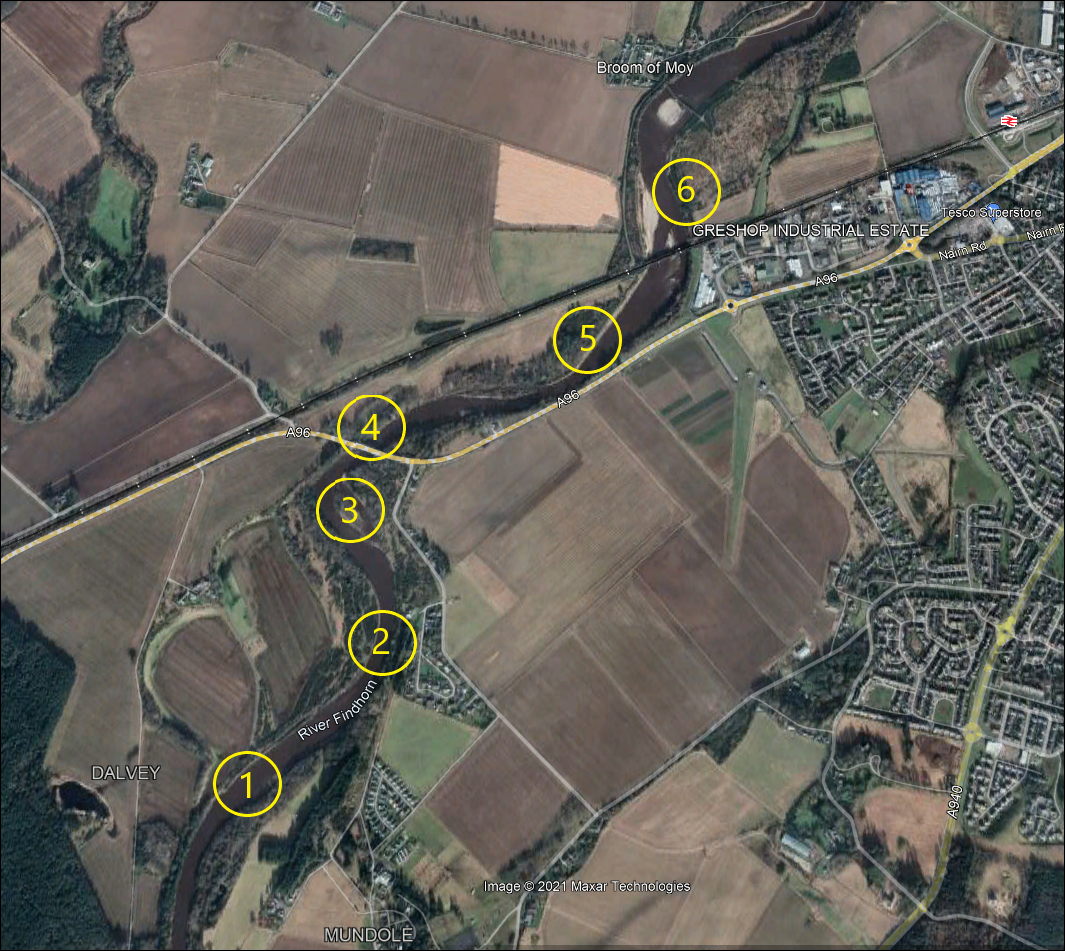
1. Red Craig 2. Stony 3. Newton 4. Suspension Bridge Pool 5. Roadside 6. Railway Pool
Click on a pool name to view pool photograph
Lower Pools, Forres Angling Association
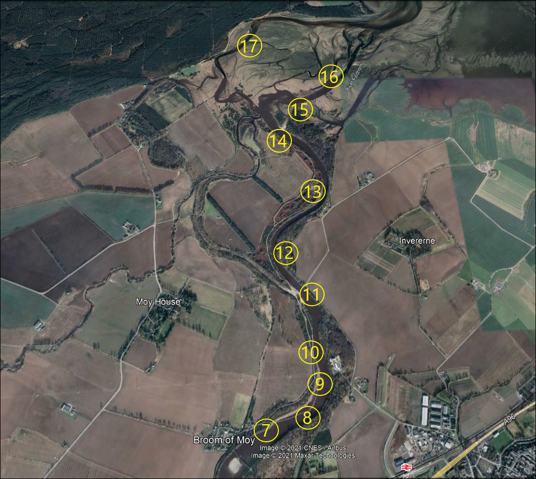
7. Broom 8. Sonnie’s 9. Gordon 10. Dump 11. Meg 12. Collins 13. Antons 14. Cloddy 15. Greenbank 16. Sea Pool 17. Skater
Findhorn Tidal Pools
The shoreline of Findhorn Bay and the lower parts of the River Findhorn, i.e. the pools below Cloddy such as pool 15 (Greenbank), pool 16 (Sea Pool) and pool 17 (Skater), are subject to constant change resulting from both variable river flows and the daily ebb and flow of the tides. It is interesting to see how the course of the river has altered over the years, in particular the changes to the lower section of the Moy Burn (or Muckle Burn) and the formation of the Breach, as shown in the Google Earth images in the gallery below.
The Breach was formed in June 2010 when a collapse of the river bank, at the tail end of Cloddy, allowed the main river to enter the Moy Burn. Further erosion of the Breach has resulted in the historic course of the lower Moy Burn becoming established as the left arm of the River Findhorn, which continues down through the Skater on its way to Findhorn Bay, illustrated clearly in the Google image of 2021. Click through the images below which show the lower tidal pools as they were in the years from 2004 to 2021.


Explore the Findhorn Bay area further on Google Maps
See additional pool photographs in the Gallery